With the engine repairs we were ready for the arrival of our next set of guests. Tri and Sandra, a.k.a. Chi Chi Maru, arrived in Georgetown just in time to get a taste of the Cruisers’ Regatta. The much hailed Cruisers vs. Bahamians ball game was scheduled for the night of their arrival. The ball diamond, complete with an official electronic scoreboard and a local play by play announcer, is a short walk from the dinghy dock at Lake Victoria and we were anchored nearby in Kidd Cove. Beer and burgers were on the menu at the ball field. What were we waiting for?
Is it any wonder that within minutes of the first pitch the score was slanted heavily in favor of the home team? The Bahamian team looked like they had practiced together a few times – the cruisers did not.
Play by play.
We were ready to say goodbye to Georgetown and the next morning conditions were favorable to head eastward across the bottom of the Exuma Sound to Long Island. We had not previously visited Long Island so it would be a new adventure for us as well as our guests. Since the route from Georgetown to Cape Santa Maria on the northern end of Long island takes you over some reportedly good fishing grounds all possible fishing gear on board was put to work. That included three rigged ballyhoo bait that had been purchased from Exuma Markets and stored in the freezer. Although I was happy to see them gone from the freezer they did not produce the desired results. When the lines were finally pulled in on our approach to Calabash Bay we had not had even one bite!
After checking out a few anchoring options in Calabash Bay we opted for the narrow channel at Joe’s Sound to spend the night. The man made entrance is barely wider than Polar Pacer with hard rocky ledges just below the surface on either side.
Edgar, from Way Point came out in his dingy to guide us in. Once we were safely past the dangerous rocks we made a left turn and a small, spotted eagle ray took over and led us down the channel to our the spot where we dropped anchor.
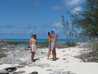
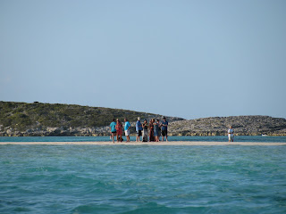
When the tide goes out, an amazing expanse of beautiful, untouched white beach appears just a short swim away from the boat. With each turn of the tide all our footprints are washed away and it seems like we are seeing it for the first time all over again. We liked it so much we stayed for three days.
Enjoying the sun on Long Island.
As we made our way from Joe’s Sound to Thompson Bay we lost use of the chart plotter for the last time. Up until then we had been able to get it to read the chart card we were using for the Bahamas if we used a random combination of removing and re-inserting the card multiple times, turning the power switch to the unit off and on again (Sound like familiar advice from an IT Help Desk?) and doing the same with the main breaker to electrical panel. Not this time. Fortunately, Tom and Tri had a back-up plan in place. Using charts loaded on a lap top and a portable GPS unit we were still able to chart a safe course to follow our course. Using waypoints entered on the very basic ‘world chart’ on the plotter we were still able to use the auto pilot for steering. Not quite as convenient as having everything integrated but doable when used in conjunction with the paper charts.
At Salt Pond, the settlement on Thompson Bay, we picked up a rental car from Fox’s Autos to tour the island. Queens Highway runs from one end of the island to the other with a few, mostly unpaved roads branching off on either side. Salt Pond sits roughly at the mid-point. Our mission was to tour the southern half of the island on the first day and the northern half on the second.
A not so subtle reminder that in the Bahamas you need to drive on the right side of the road.
Clarence Town is home to two landmarks; St. Paul’s Anglican Church dating back to 1848 and the relatively newer St. Peter’s Catholic Church. Both were built by the same man, John Cecil Hawes (a.k.a. Father Jerome) during different periods of his religious affiliation.
Several abandoned salt ponds are visible from Queens Highway. All that remains from their productive days are the stone walls laid out in a grid pattern.
The road to the beach at yet another unfinished Bahamian real estate development.
Grounded and now a building site for ospreys.
Dean’s Blue Hole is a popular stop for divers. At a depth of 663 feet it claims to be the deepest blue hole in the world. A warning sign posted nearby advises that less than competent swimmers should not venture near or in the hole. We steered clear. Besides, we did not want to spend the rest of the day in salty clothing.
No visit from Chi Chi Maru would be complete without Tri foraging for items that he could use to cook a gourmet meal on board. Here he searches for tamarind pods mature enough to pick while Tom and Sandra enjoy refreshments at the Max Conch Bar.
In the small convenience store next door to the conch bar we met an elderly resident who told us about growing up in a neighboring settlement and moving to her current home when she married in 1942. She has lived in the same house ever since. She talked about traveling to Nassau from Long Island by primitive sailboat in the early days, a trip that could take several days, and the transition from sail to different level of power boats. Now there is an airport just a few minutes away and when she goes to visit her family in Nassau she flies there in less than an hour.
On the second and last Saturdays of each month there is a small farmer’s market in Salt Pond. We were running low on fresh fruit and veggies and since we had the rental car it was an opportunity to stock up. Opportunities with transportation should never be passed up.
There were about half a dozen vendors at the market. The typical offerings were papaya, bananas, sweet potatoes, onions, cabbage and sugar cane. Not a wide selection but fresher than anything we were likely to find in the local grocery stores.
Day two of our Long Island road trip took us to the northernmost tip of the island, Cape Santa Maria, the location of the Columbus Monument.
Erected on the high cliffs overlooking Exuma Sound, the monument is dedicated to the Lucayans, “The gentle, peaceful and happy aboriginal people of Long Island and the arrival of Christopher Columbus on October 17th, 1492.”
The road to the monument is little more than a long rocky, non-maintained trail almost overgrown by buttonwood and other small shrubs. We got a surprised reaction from the locals when we told them we made the trip in a rental car.
The view was worth the bumpy ride.
Other highlights to our northern tour were the beach bar at Deals where we watched television coverage of the earthquake and nuclear plant disaster in Japan,
the tiny Stella Maris airport where we met Stella napping in the sun,
the cave at the Stella Maris Resort where night time parties with the bats are hosted for guests.
and the rock formations created by the ocean on the eastern side of the island directly across from Salt Pond.


