Tuesday, June 29, 2010

The Carolinas and Virginia - June 3 to 13, 2010

Travelling north from Charleston we retraced our steps in some areas and covered new ground in others. The ICW from Charleston north through South Carolina to Myrtle Beach passes through several wildlife preserves. The terrain is mostly tidal marshes and cypress swamp. It really is quite beautiful. The waterway is noisy during the day with the sound of many birds I could not identify and at night the bullfrogs made short work of what would have otherwise been a very quiet anchorage. We saw many occupied osprey nests and lots of turtles sunning themselves on fallen trees. We even saw a few alligators who quickly ducked under the water when they saw us coming.

Duck hunting tower in the marsh?

Enjoying the early morning sunshine

Navigation markers make good nesting sites for osprey.

American Eagle

As we approached Myrtle Beach it was obvious that there were not a lot of places to get off the ICW and drop an anchor so we stopped at a small marina that was close by. Let’s just say that it was another part of the adventure. The building that housed the toilets and showers burned down about a year ago and it does not appear that there is any intention to rebuild. The docks are in rough shape and the prices are higher than what Skipper Bob reports. They are connected to a boatyard that was apparently quite busy at one time but is now in a sad state of decline. There is a collection of boats that are in various stages of repair. Some might still be salvageable.

Hague Marina – some boats never leave

A long term resident – maybe part of the Prout family??

Myrtle Beach is a Mecca for golfers. We passed by several golf courses that bordered the waterway. There was even one that spanned the waterway with a chair lift to get the golfers and their clubs to the other side.

We are more used to seeing chair lifts in the mountains with their racks filled with skis.

Myrtle Beach Mansion – not on the beach though

Myrtle Beach is not the only game in town. There are many ocean beaches to choose from. We could see some of them from the waterway. I have seen newspaper notices advising which beaches are open to motorized vehicles.

This must be one of them.

High rise storage along the ICW

We were still in the Bahamas when the BP oil well disaster first happened. There was much talk about it among the sailing community with some speculation about whether or not the oil slick would travel around the tip of Florida and get picked up by the Gulf Stream. I don’t know what the chances of that happening are but it would definitely add to the devastation.

Someone has a strong opinion about the situation in the Gulf.

When we stopped in Wrightsville Beach for Halloween 2009 the weather was not conducive to spending any time in the water. Only a few windsurfers with heavy duty wet suits were in the water. This time the water was just a little warmer and the beach was just a little busier.

Wrightsville Beach in season

Paddle boarding is a trademark of Wrightsville beach. You can even take lessons if you are so inclined.


We passed through Camp Lejeune once more without any delays due to military exercises.
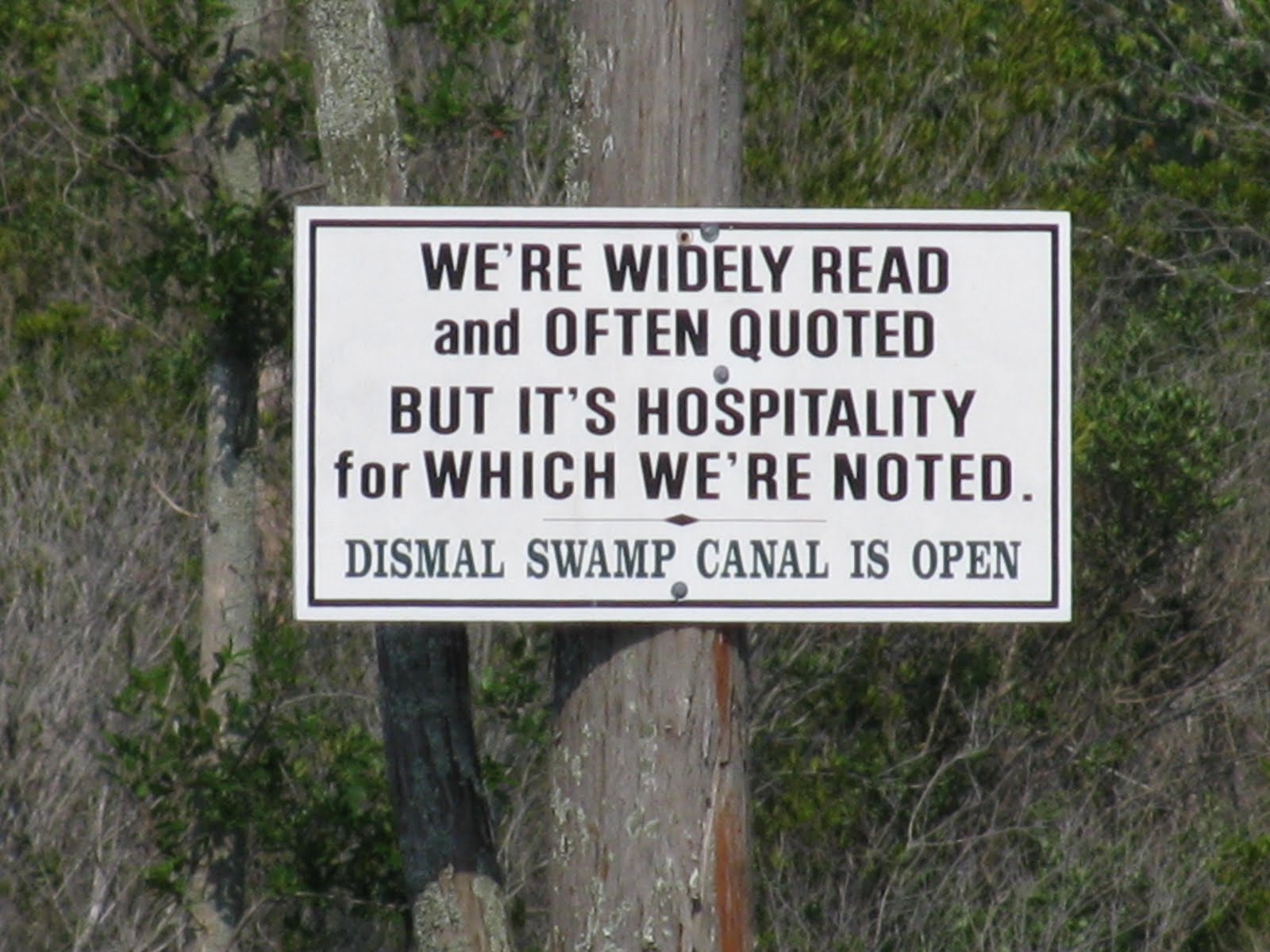
Drumming up business for the Disamal Swamp

In spite of these signs enticing northbound travelers we chose the Virginia Cut as our route from the Alligator Bridge to Norfolk, VA as we had taken the Dismal Swamp southbound last fall. The little community of Coinjock looked like it would be a good place for a cruiser gathering but since we were the only cruisers in sight there wasn’t much point in stopping so early in the day. We were also excited about the possibility of connecting with Ajaya after hearing them check in with the Cruisheimers Net on Single Side Band from the Dismal Swamp. We would both reach Norfolk about the same time.

I had not thought about snakes being one of the dangers we would need to look out for during this life on the water. That changed on our trip up the Virginia Cut. We had anchored near the Pungo Ferry Bridge and were visiting with a couple of our very newest friends, Jim and his son Andy, who just happened to be passing by in their skiff and had stopped to say hello. They hardly had time to open the cold beer we offered them when we spotted a snake heading towards the stern of Polar Pacer in a very determined manner. We had apparently intruded on its territory and were not welcome. It was not impressed by Tom’s attempts to chase it away. Each time he picked it up with the gaff and tossed it away from the boat it just turned around and came back towards us. As we were not crazy about being joined in bed by an unwanted reptile during the night the world is now minus one ugly snake. A Google search later confirmed our suspicions that it was a rather poisonous water moccasin which is common to the area. And yes, they have been known to climb up an anchor chain!

No, I did not scream, I ran for my camera.

As we passed through Norfolk we heard Canadian Warship 701 on maneuvers warning all boats in the area to stay clear of the divers in the water. Several days later Tom hailed it on the radio and learned that is was HMCS Goose Bay. We also had contact with Ajaya and made arrangements to meet at the Hampton Public Piers. Luna, a Danish registered cruising boat, whom we had collected at one of the bridges, would join us as well. We hung out in Hampton for a few days shopping, eating, listening to blues and socializing knowing that we would soon be in Deltaville in a boatyard working on a very long job list. We even rented a car and went to the mall. Hanni and Roger – we missed open mic night at Good Fellas and the regular shows don’t start until 10PM. Just a little late for us.

Mimosas for brekkie – then buy all the seafood left at the end of the farmers’ market and have a decadent pot luck of shrimp, scallops, skewers and mackerel.

Shrek For Ever – 3D on the IMAX screen – Awesome!

One cruiser who just didn’t know when to quit.


Sunday, June 6, 2010

Fernandina Beach to Charleston

Fernandina Beach to Charleston - May 21 to June 1, 2010

The community of Fernandina Beach is located on Amelia Island at Florida’s northeastern tip where it borders Georgia. It has a well maintained historic district nestled between two large paper mills that are not particularly offensive once you are onshore. There are dozens of shops and restaurants within easy walking distance of the marina where we spent our first three nights back in the land of plenty. Plenty of hot water that is. We had our first indoor showers since Canada won the gold medal hockey game at the Olympics!

There is also a wonderful farmer’s market on Saturday mornings where we were able to buy fresh local produce. What a treat.

Visitor at the dock in Fernandina

Before we could start our journey north we had to go south again. Armed with our job list of 103 items we headed down the ICW to St. Augustine and Sailors’ Exchange in search of bargains on boat parts.

St. Augustine sky line

We made four trips to Sailors Exchange on foot up King Street and across the river to dig through the dusty bins of new and used treasures. Our best finds were a new helm seat and a self tailing winch to replace the one at the mast. We saved about $500 on those two items alone! It was well worth the trip

The original helm seat

So much more comfortable and one item crossed off the job list too.

On each one of our trips we passed this giant soccer ball anchored in the river near the bridge.

If you want to build one you can find instructions at www.earthball.org

While in St. Augustine we deciphered the Sunshine Bus Company’s system and treated ourselves to some extreme retail therapy at Wal-Mart and the Winn-Dixie supermarket. There were too many choices and we came away without too many bags full. The other controlling factor was the idea that when we haul the boat we will need to empty everything out while we do the interior work. The less we have to pack up the better. An unexpected bonus was our very first seniors’ discount ever! The sign on the bus indicated a discount for ‘over 60’ but the driver asked if we were over 55 and gave us the reduced rate of 50 cents instead of a dollar.

We have been told that anyone who claims to have taken a boat down the Intracoastal Waterway without going aground is a liar. Okay. We can’t be called liars anymore. Yes, Polar Pacer has been aground on the ICW. Just a couple of minutes of not paying enough attention and one of our bows was stuck in the mud at the side of the channel. The embarrassing part was having to ask the power boat to ‘wake’ us and make a big enough wave to wash us off the bottom after asking the captain for a slow pass as he approached from behind at a high rate of speed.

Shortly afterwards we came across a family in need of a little assistance. They were out for a nice Sunday afternoon of fishing but had some motor problems and were adrift in the ICW. We had them throw us a line and gave them a tow as far as the Sisters Creek Bridge.

Tow Boat Polar Pacer to the rescue.

Someone was out to remind us that we had missed a certain nephew’s birthday earlier in the month and had a sky writer do the job.

First Word

Second word

Self explanatory

There is a lot of residential development along some parts of the ICW and many of the homes come with private docks.

Boat houses as far as the eye can see.

Some do not match the elegant architectural style of the homes they belong to.

As we had missed the big cruisers Thanksgiving pot luck gathering at St. Mary’s, Georgia on the southbound trip we made a short stop to have a look and meet friends. We arrived the day before the second annual Fun in the Sun Festival that coincided with the Memorial Day Weekend. The line up of events included . . . . .

A pet fashion show,

A climbing wall,

A rubber duck race in the tidal current (Our duck, number 2576 in the middle of the pack, did not win despite our words of encouragement from shore.),

The blessing of the fleet

And patriotic entertainment by the Navy band from Jacksonville.

One piece of advice we had been given before we left Canada was to avoid travelling the ICW on a weekend. That’s when all the crazy people come out and cause havoc on the water. A long weekend would be especially bad. Time for another offshore passage. Thirty hours offshore would take us from St. Mary’s Inlet to Charleston. The same trip southbound took almost two weeks.

We left St. Mary’s at sunrise on Sunday morning and headed out to sea.

We have come to appreciate the reliability of American aids to navigation.

Three hour watches on an overnight passage seem to work for us. That gives the ‘off-watch ‘person enough time to update the ‘on-watch’ person and wind down enough to get some REM sleep. We record our position and plot it on the paper chart every hour. That way, if anything should happen to our electronics we will still have a pretty good idea where we are and can put a backup plan in operation.

Sticky arrows don’t damage the chart and can be re-used for the next trip.

Charleston is one of those cities that deserve a repeat visit and the nice man from Customs and Border Patrol who checked us in at the marina told us about the Picollo Spoleto arts festival. We decided to stay an extra day and treat ourselves to some culture. As we walked through the well preserved historic district we happened on a lunchtime performance by the Dancentre South Company at the Footlight Players Theatre, and an exhibit of works from the ‘70’s and ‘80’s by artist Terry K. Hunter and a wine tasting at the market Street Winery. We were exposed to some extreme architectural contrasts in the Customs House and the Arthur Ravenel Jr. Bridge.

Terry K. Hunter was on exhibit in the lobby.

Column detail.

Crossing the Cooper River

At one time it was not considered proper for ladies to entertain company when their husbands were not in residence. When plantation owners returned from trips to the islands they would put a pineapple on display at the entrance to their property as an indication that they had returned home and it was time to party.

Charleston is always ready for a party

Cooling down

Wednesday, May 26, 2010

Westward Gulf Stream Crossing – May 18 to 20, 2010

At 6:30 AM on May 17 we made contact with Chris Parker, our weather advisor who we can communicate with via SSB radio in the absence of the internet or VHF weather networks. He indicated that we could expect sustained squalls and thunderstorms with winds between 30 and 40 knots later in the day and into the evening. With that in mind we decided to delay our departure.

A spectacular final Bahamian sunset

The next morning’s three day forecast called for light winds with some isolated squalls. We had a good weather window to head for Fernandina Beach. Ft. Pierce and Cape Canaveral were possible bail out points if things turned nasty. Fernandina Beach was far enough north that we could take advantage of the Gulf Stream to carry us there. We would take turns being on watch for three hours at a time and hoped we would be able to sleep in between watches. Passages (NH) would make the crossing with us. It was good to be able to call them and compare notes when all we could see was the sea and the stars. A little bit of conversation makes the night watches go that much quicker.

We pulled up the anchor and left Great Sale Cay on schedule. The wind was mostly on our nose so we had to motor in order to maintain a speed of 6 knots. Our initial course took us NNW to Matanilla Shoal where we turned to the NW for entering the Gulf Stream. The sky was partly cloudy and we used the radar to watch for squalls. We only saw two in our vicinity. The closest one was 3 nautical miles away.

One of two squalls we saw.

We reached the Gulf Stream late in the evening of day one. The farther west we went, the stronger the current got. By sunrise our boat speed had increased to 10 knots although we had kept slowing the engine down. The current was faster and wider than we had expected. The waves were small We had to slow down even more or we would arrive at Fernandina in the dark which we did not want to do as St. Mary’s Inlet can be busy with outbound fishing boats and submarines from the nearby naval base. To kill some time we put up the sails and turned the motor off. We were still travelling at 6 knots in very light wind.

Flat water in the Gulf Stream

During the evening of day two we started the motor again when we needed to leave the Gulf Stream and turn west towards land. At that point we were counteracting the effect of the northerly current. We reached the red and white buoy marking the entrance to St Mary’s Inlet at 7:00 AM on day three. There had been very little traffic on the water .Fishing boats were just starting to come out and there had not been any announcements for submarine traffic.

Early morning fishing trip.

A pilot boat heading out from Fernandina Beach to make a crew change.

Historic Fort Clinch guarding the entrance to St Mary’s Inlet

We picked up a mooring ball at Fernandina Harbor Marina, went ashore and walked the few blocks to the Customs and Border Patrol office to check in. The crossing and return to the US was uneventful, just as it should be.

As of now our plan is to return to the Bahamas next winter. Then again, our plans are often drawn in the sand at low tide and get washed away with the next tidal cycle which at most is about six hours away.

In the meantime we are making our way up the US coast to find a boatyard where we will be safe from any hurricanes and can do some improvements to Polar Pacer. After living aboard for almost a year we have some ideas to make her just a littler more comfortable and user friendly.

Leaving the Bahamas – May 7 to 18, 2010

Norman’s Cay was a very brief last stop in the Exumas. We would have liked to spend more time there exploring the island. Oh well – some things should be left for next time.

A partially submerged plane that would have been a cool site for snorkeling.

This island looked like a good picnic place.

Mega Yacht

The forecast called for two more days of calm weather followed by a week of strong winds. We needed to be somewhere that would provide protection and time was going to run out for us to get back to Abaco so we could spend a bit more time there before we made our way back to the US.

Plan A was to continue up the west side of the Exuma chain then cross Exuma Sound to either Royal Island or Spanish Wells, spend the night and continue on to Little Harbour on Great Abaco in the morning. About the time we finished threading our way through the menacing looking black patches of coral (We later learned that they were actually only a foot or so above the sea bed and we could have sailed right over them.) as we rounded Beacon Cay and Sail Rocks at the northern tip of the Exumas Plan B evolved and took over. The calm conditions were perfect to go directly to Little Harbour. I was nervous about entering the cut from New Providence Channel to the Sea of Abaco, picking our way through the narrow channel into the harbour and picking up a mooring ball – all in the dark. There are just sooo… many big rocks out there. The moon would not even be there to help us out. Tom was confident that it would be a piece of cake in the flat calm. Of course he was right.

We crossed the New Providence Channel shipping lane while it was still light and our AIS showed that we were well clear of any big ships crossing to or from the Atlantic. Besides increasing our sense of safety, AIS is a source of entertainment during a night watch. When a vessel is spotted on the chart plotter AIS will provide details about it. Among the vessels that we saw that night were the cruise ship Carnival Liberty; 962 feet long traveling at 17 knots headed for Miami with and ETA of 10 AM the next day and the cargo ship Yannis L with a destination of Turkey and an ETA of May 25.

Sunset over flat water on the New Providence Channel

We approached Little Harbour Cut around 2 AM. The light marking Little Harbour Cut was very visible and the waypoint we had used when we left two and a half months earlier got us back in without incident. Our 1.5 million candle power flashlight lit up the rocky shore and helped us to locate the channel markers and a vacant mooring ball.

These channel markers are not very easy to see even in daylight with their peeling red and green paint.

At 2:30 AM we crawled into bed after a very long day on the water. We woke to a bright sunny morning surrounded by sea turtles. Our friends on Ajaya, who we had said goodbye to in Georgetown , were on the mooring ball next to us. What a nice surprise.

Turtle greetings

We spent a recovery day in Little Harbour before setting off again.

Waiting for the bar to open at Pete’s Pub

Walking the beach is not always a pretty picture. Atlantic storms send a lot of human garbage ashore, most of it plastic that has fallen or been thrown overboard from boats or has been washed out to sea from land when not disposed of properly. Some of this stuff has travelled thousands of miles before it ends up on Bahamian beaches. Besides being unsightly it is not good for the wildlife.

We all need to do our bit to stop this from happening.

Our time in the Bahamas was coming to an end. While we were still making new friends and reuniting with others we had not seen in several months (Roger and Hanni – remember Reves d’Ocean from Deltaville?), the desire to linger and explore was not as strong as when we first arrived. We picked up some provisions in Marsh Harbour, filled the diesel cans and checked our weather sources. Moderate easterly winds with scattered squalls and thunderstorms were expected for the next week. It was time to make our way to the top of the Bahamas and stage for another Gulf Stream crossing.

Tilloo Cay architecture

Marsh Harbour, busier than our last trip through.

We caught up with friends on Passages (NH) once again at Bakers Bay – a resort in progress on Great Guana Cay. From there we had a smooth trip together around “The Whale” and back into the Sea of Abaco where we were joined by two large dolphins who swam with us until we reached Green Turtle Cay, moving between the two boats and playing at our bows. As I watched them swimming between the hulls at our bow one of them jumped in the air several times and “barked” at me as if to say “goodbye”. It was amazing.

Typical Bahamian colour scheme.

We anchored at Powell Cay and went ashore for some last chance beachcombing. We were disappointed that the only sea glass we found was not ready for picking. Most of the pretty shells still had creatures living in them except for the sand dollars which we already had plenty of from Baker’s Bay.

Smoke from the fires on Great Abaco that are destroying the food supply for the wild horses. At night the red glow from the fires was visible in several locations.

Next stop – Great Sale Cay where we had entered the Bahamas five months ago. We were prepared to to start our westward Gulf Stream crossing from there to Fernandina Beach, Florida on Monday, May 17th. The 300 mile trip would take approximately 48 hours at an average speed of 6 knots per hour. If we left Great Sale at 10:00 AM we should arrive at 10:00 AM on May 19th.

Relevant Reading – An Artist on His Island, a Study in Self Reliance

This is a diary from 1950 to 1974 of Randolph W. Johnston, a Canadian sculptor who took his family in search of a deserted island where they could be self sufficient and avoid the regimentation and expectations of modern society.

They ended up in Little Harbour, Abaco where it took them many years to establish a rudimentary garden, and build a house and studio while raising three young boys. Randolph describes how they overcame the difficulties of obtaining the financial and material resources necessary to make his dream come true in such a remote location.

Today, Randolph’s youngest son, Pete, still lives in Little Harbour where his art gallery and lost wax foundry are a tourist attraction and Pete’s Pub is a popular watering hole for cruisers and locals. There is a road and internet service via satellite but the community is still self sufficient when it comes to electricity to the point where there is much opposition to a new power plant under construction nearby.

The Johnston family used this cave at Little Harbour for storing their possessions and also lived in it briefly before they were able to build a house. It is for sale.

Simple Slaw

Every time I make this coleslaw for a pot luck meal people tell me how good it is and many have asked for the recipe. Here it is. I found it on a package of shredded cabbage that I bought at the Price Right grocery in Marsh Harbour. I think the secret is the dressing.

Ingredients:

4 – 6 cups of shredded cabbage

A small handful of raisins

A few spoonfuls of pineapple bits, canned or fresh. Crushed works too.

Optional additions:

Green onions

Thinly sliced celery

Shredded carrots

Chopped apple

Dressing:

Equal parts mayo, vinegar and white sugar. For 4 - 6 cups of cabbage I use 1/4 - 1/3 cup of each. Use whatever amount gives you the consistency you like.

Vinegar is not just for salads.

We have found two other valuable uses for vinegar on the boat.

The first was when Tom was doing all the epoxy work to repair our detached bulkheads after the first Gulf Stream crossing. Instead of buying expensive solvents and chemicals to clean up drips and brushes he used plain vinegar. It worked like a charm and is not toxic. Better for us and the environment too.

The second is to pour it in the head and let it sit overnight to dissolve the deposits that build up. It cleans the bowl and keeps the flushing mechanism (bilge pump) on our Lavac toilet working smoothly. Do it regularly and don’t scrimp. It will be more pleasant than having to dismantle everything to clean it. We know from experience.